GPSkySafety(Sea) Crane Height Safety System
Product Summary
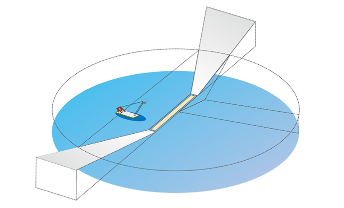
- Sea
GPSkySafety is a safety system that utilises high accuracy RTK-GNSS. By utilising a GNSS Antenna placed on the crane along with a few parameters, real time automatic safety calculations are made that will be used in the guidance system. Compatible with network based RTK-GNSS, GPSkySafety provides high accuracy positioning and guidance service virtually anywhere with GNSS Correction Service. Precision is measured to be within 2cm.
Features
GPSkySafety(Sea) Main Features
- Centimetre Level Accurate Positional Data using RTK-GNSS
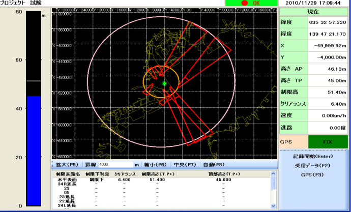
- Display Real Time Position, Work Limit Area and Height Overlaid on either Topographic or Geometric Maps.
- Height Clearance Setting and Warning
- Change operation parameters to fit operation environments
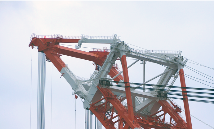
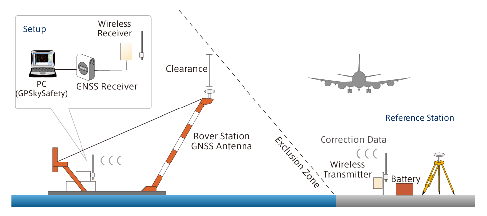
System Overview
RTK-GNSS (example)
Network type RTK-GNSS (example)
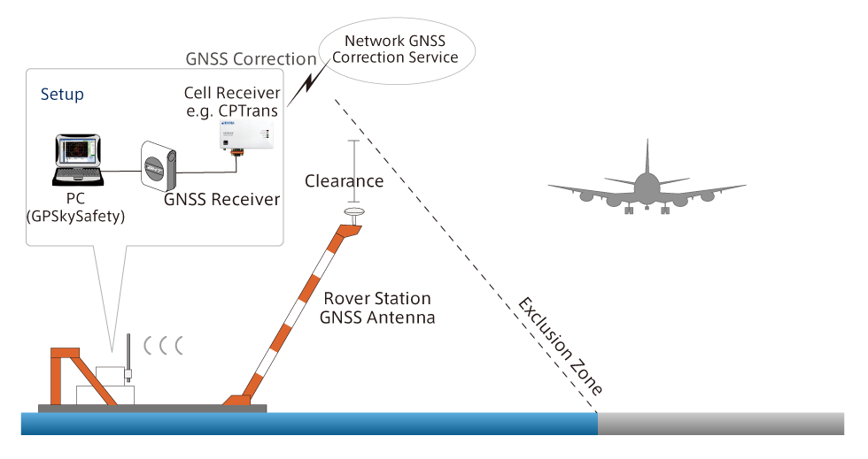
GPSkySafety is designed to be a flexible system that can function in a multitude of different operation environments and utilising different equipment.
※Usable with any GNSS Receiver utilising NMEA Format
※Usable both on land or sea
Height Visualisation
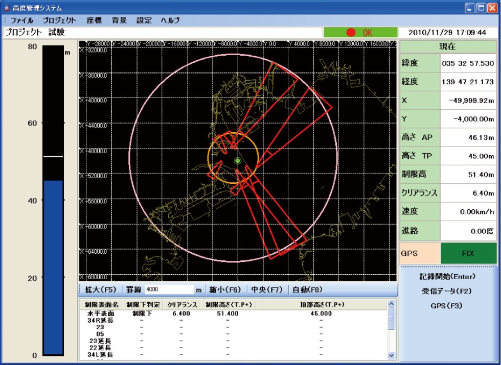
Use a specialised software made to visualise crane height and current operation height clearance to quickly analyse the current task and to decide on the best course of action with ease. In the event that the boom approaches the set height limit, both the operator and manager will receive an audible and/or visual warning on their terminal.
Compatible with LandXML
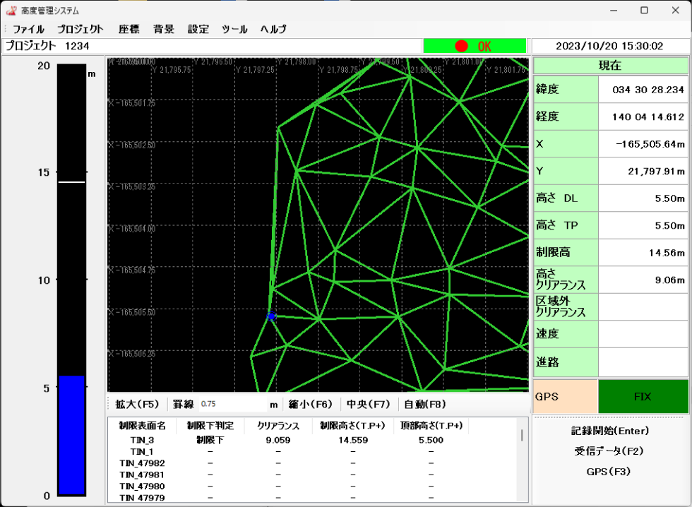
As of 10/2023, height limits can be used in LandXML Data.
Recommended Specification
| Terminal |
・Windows 7 ・Pentium 4 1GHz or above ・Memory 2GB or above ・RS-232C and/or USB Port |
|---|