SmartScraper Road Excavation Measurement System
Product Summary
- i-Con
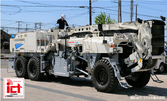
SmartScraper is a management system for road/asphalt excavation operations that simplify tracking, measurement and reporting. SmartScraper eliminated the needs of multiple ground crew by bringing modern technology to the workplace, increasing safety, reducing error and increasing overall efficiency of the operation.
Features
SmartScraper Main Features
- Simplification of Area Management
- Simultaneous Positioning and Depth Measurement
- Real Time Record Keeping with 3D Data Point Output
- Compliance with Japan ICT Construction; Road Project Management Completion
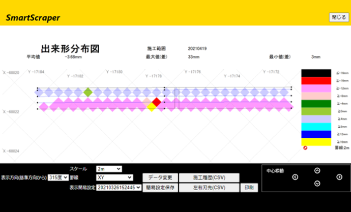
Complete Measurements and Records
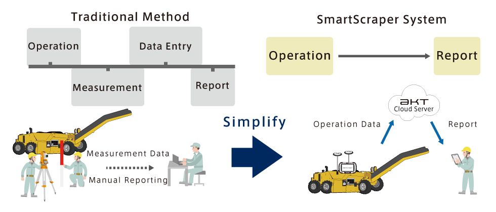
Compared to the traditional method, whereby workers must measure and write the width and height level of the asphalt, SmartScraper System records the completed area and thickness removed in real time, reducing the number of crew members needed for an operation and eliminating human errors.
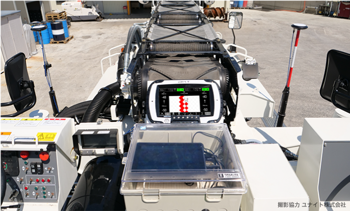
Simultaneous Positional and Depth Record
Using GNSS positional data and depth data gathered using OCR, it is possible to show and record the progress of the excavation.
Instantaneous Report
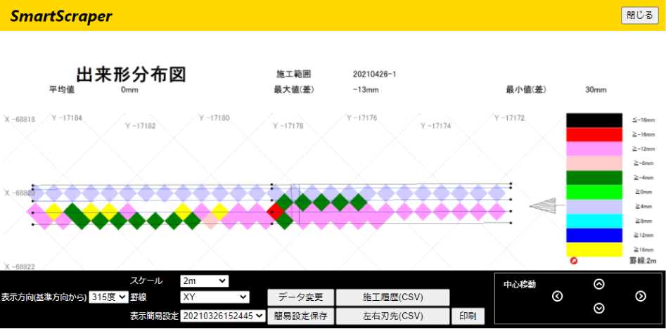
All the data is saved into the cloud, giving instant access to the operation records for analysis and for printing.
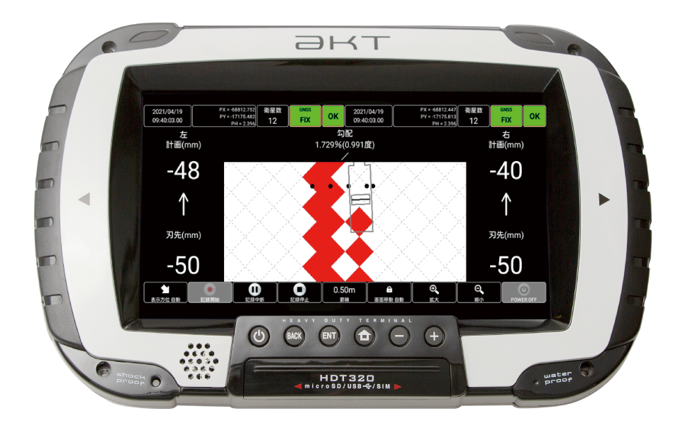
Rugged Multi-Purpose HDT320
Designed for the rugged, unforgiving environment of the worksite, the HDT320 is a tablet designed with the user and the workplace in mind. Equipped with 2 dual-frequency GNSS modules, tough IP67 rated casing, vibration and impact resistant body, the HDT320 will be an indispensable workhorse equipment for multitudes of different operations.
Dual-Frequency RTK-GNSS Receiver Terminal HDT320 [Page Link]