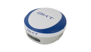
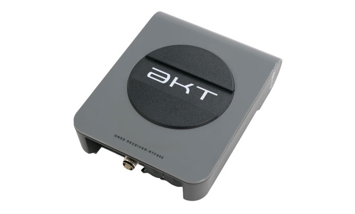
RTF800 Dual-Frequency RTK-GNSS Receiver
Product Summary
- NEW
- i-Con
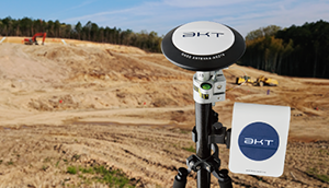
RTF800 is a high accuracy high precision Dual Frequency RTK-GNSS receiver capable of centimetre level accurate positioning. Equipped with Septentrio mosaic-CLAS GNSS module and AIM+ Technology for stronger jamming and spoofing resistance.
Features
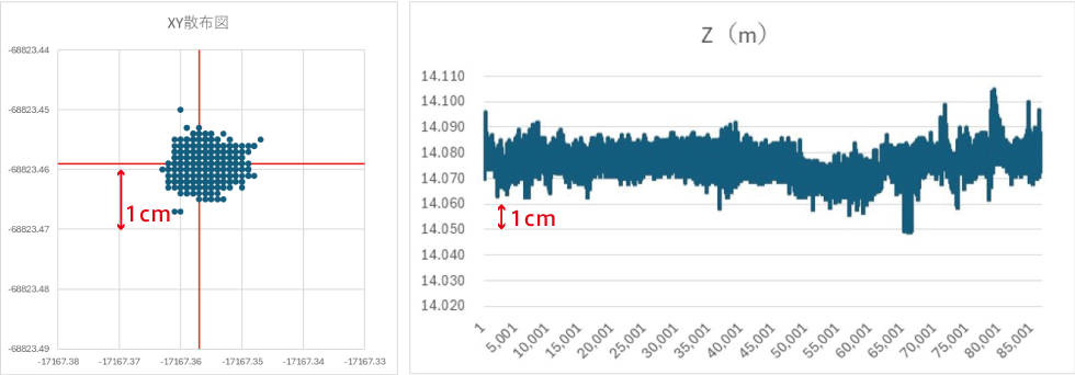
Centimetre-Level Accurate Positioning
RTF800 brings amazing performance at a more reasonable price compared to traditional RTK- GNSS Receivers. RTF800 boast a ± 2~3cm horizontal and ± 2cm vertical precision.
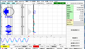
Data Points Gathered in 24 Hours Period
Improved Jamming and Spoofing Resistance
Utilising Septentrio mosaic-CLAS GNSS module with advanced AIM+ tech- nology for a much greater jamming and spoofing resistance.
Septentrio:AIM+ GNSS jamming protection[External link]
CLAS compatible
source:QZSS Website
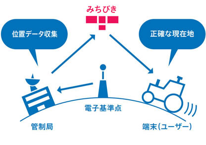
CLAS
CLAS stands for Centimetre-Level Augmentation Service. It is a Japan exclusive service that uses QZSS (Quasi-Zenith Satellite System) Michibiki satellites to stream positioning augmentation data directly from satellite for cm-level positioning. Since CLAS Augmentation Data signal is sent through the L6D band, the same as GPS, special equipment must be used to pickout the Augmentation Data.
Higher Accuracy than DGNSS
Utilising CLAS Augmentation Data to achieve centimetre level positioning for high accuracy positioning and measuring operation in remote areas of Japan.
CLAS Low Running Cost
CLAS Augmentation Data Stream is free to use, driving the cost of operations for many high accuracy positioning down.
IP65 Rated
Tested to withstand jets of water from all direct- ions, dust tight, shock and drop resistant.
※For Outdoor Use (Requiring GNSS signal)
※In-house drop test done at 1.5m onto bare concrete
AAA Battery Operated
The RTF800 uses 4 standard AAA batteries to operate, making replacement and on- the-field recharge a breeze. Also compat- ible with rechargeable AAA types.
※Capable of running on external power source
Specification
| GNSS Signals | GPS: L1 C/A, L1C, L2C, L2 P(Y), L5 GLONASS: L1 C/A, L2C/A, L3, L2P BeiDou: B1I, B1C, B2a, B2b, B2I, B3I Galileo: E1, E5a, E5b QZSS: L1 C/A, L1 C/B, L1C, L2C, L5 |
|---|---|
| Precision | RTK 0.6 cm + 0.5 ppm |
| Channels | 544 |
| Cold Start | <45s(Changes with Environment) |
| Refresh Rate | Max 10Hz |
| Format | NMEA 0183 RTCM v2.x, v3.x (Incl. MSM msg.) CMR v2.0, CMR+ (Only CMR+ Input) |
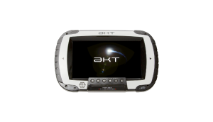
| OS | Windows10 IoT Core |
| CPU | Qualcomm Snapdragon 410c ARM Cortex A53 core 1.2GHz |
| Memory | RAM : LPDDR 1GB, ROM : eMMC 8GB |
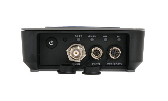
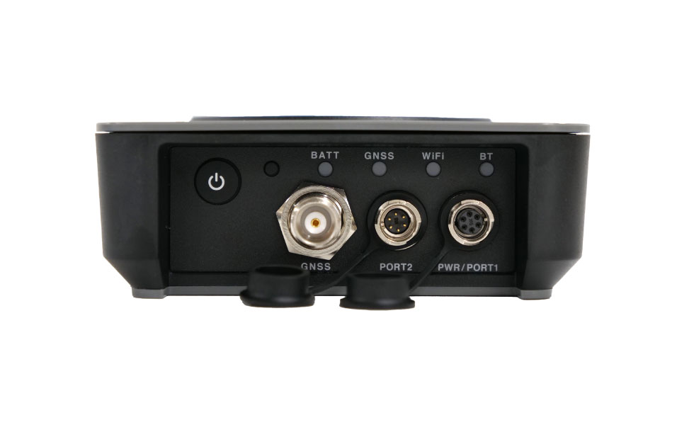
| LED Indicator | Battery Status, GNSS Status, Wi-Fi Status |
| Wireless Interface | Wi-Fi : IEEE802.11 b/g/n |
| Interface | RS232C Serial Port × 2 |
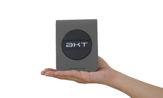
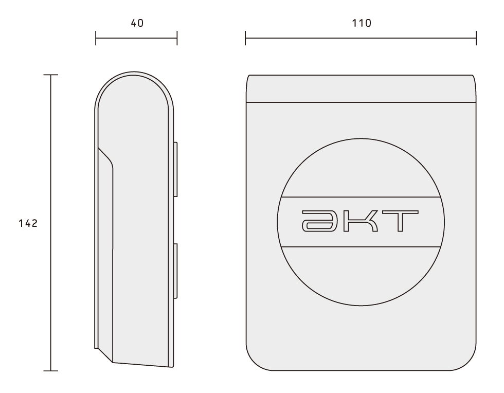
| Dimensions | 110 x 142 x 40 mm |
| Weight | 332g (w/o Battery) |
| External Voltage | DC 9V ~ 36V |
| Battery Life | ~ 4 Hours |
| IP Rating | IP 65(When using protective cap) |
| Operating Temp | -20℃ ~ 60℃ |
| Operating Humidity | Non-Condensing Max @ 95% Relative Humidity |
| Impact Res | Dropped from 1.5m onto bare concrete |
※Please note that product specifications may change without prior notice.
Dimensions (mm)
Other products information