EagleEye Slope Deformation Monitoring System
Product Summary
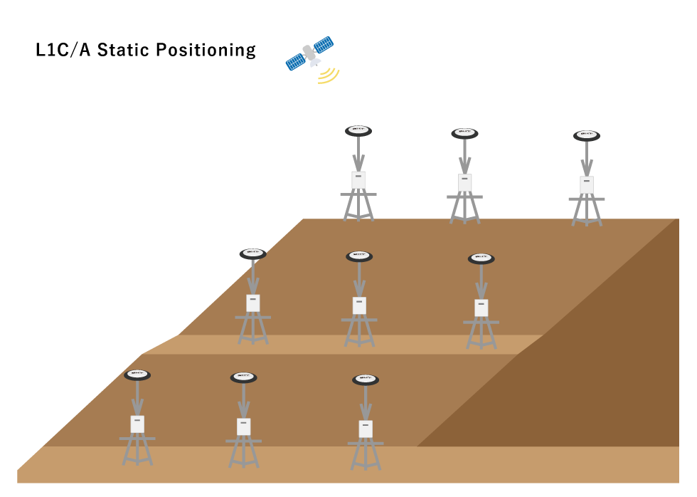
EagleEye is a mm-level accurate deformation monitoring system that utilises surmised data from single frequency GNSS static position data that was then analysed in 15 minutes intervals. EagleEye provides a reliable, all year round monitoring and warning system for terrain deformations in infrastructure projects such as railroads, dams, tunnels etc.
Features
EagleEye Main Features
- Millimetre-Level Accurate Positioning
- All Year Round Constant Monitoring
- Increase Safety and Increase Quality of Operation
- Highly Accurate and Precise Positional Reading Every 15 Minutes
Accuracy to the Millimetre
By utilising single-frequency GNSS to get static positional data, EagleEye can achieve reliable mm-level positional data. With 5mm positional data resolution and 24/7 recording, early detection and prevention of catastrophic landslides can be done more effectively and easily. The time-frame resolution of the data is 15 minutes and the positional data is analysed every 6 hours.
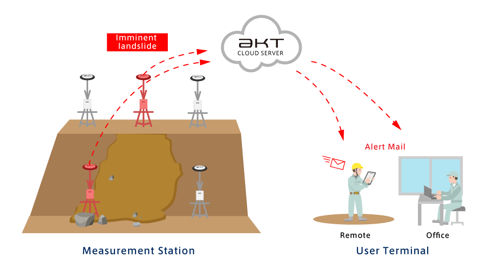
System Overview
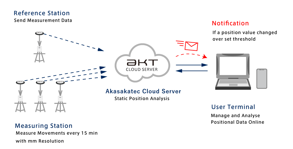
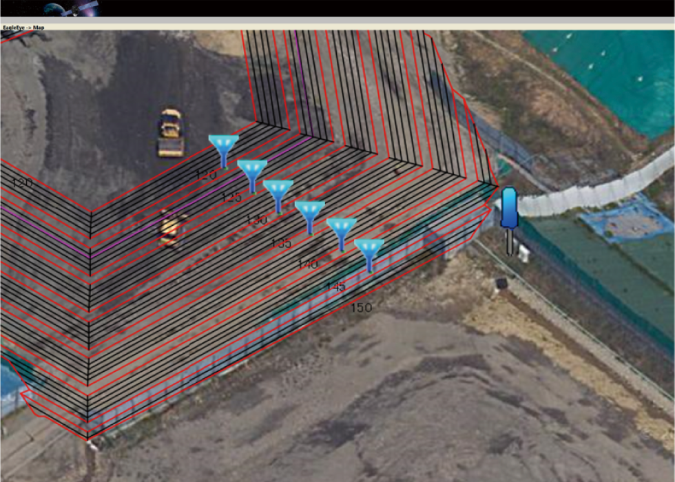
Positional data is gathered using GNSS positional data via GNSS receivers set to reference station (Base Station) and multiple monitoring stations (Rover Stations) in order to get high accuracy positioning. The data is sent automatically to a cloud server where it is analysed by a terminal such as a PC.
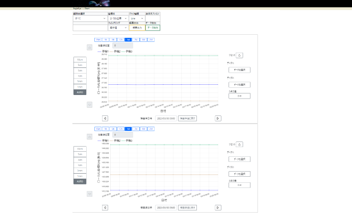
View Analysed Data (Picture Examples)
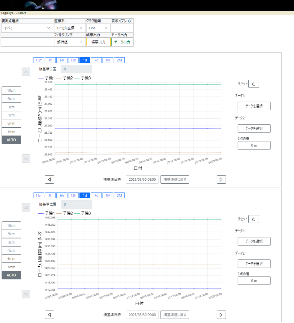
Accessible via a special website.
Alert System (Picture Examples)
When certain parameters are met, alert mail will be sent.
Web Page (Picture Examples)
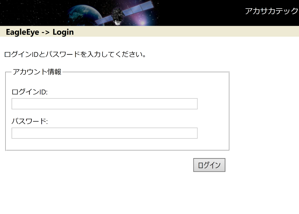 Login screen
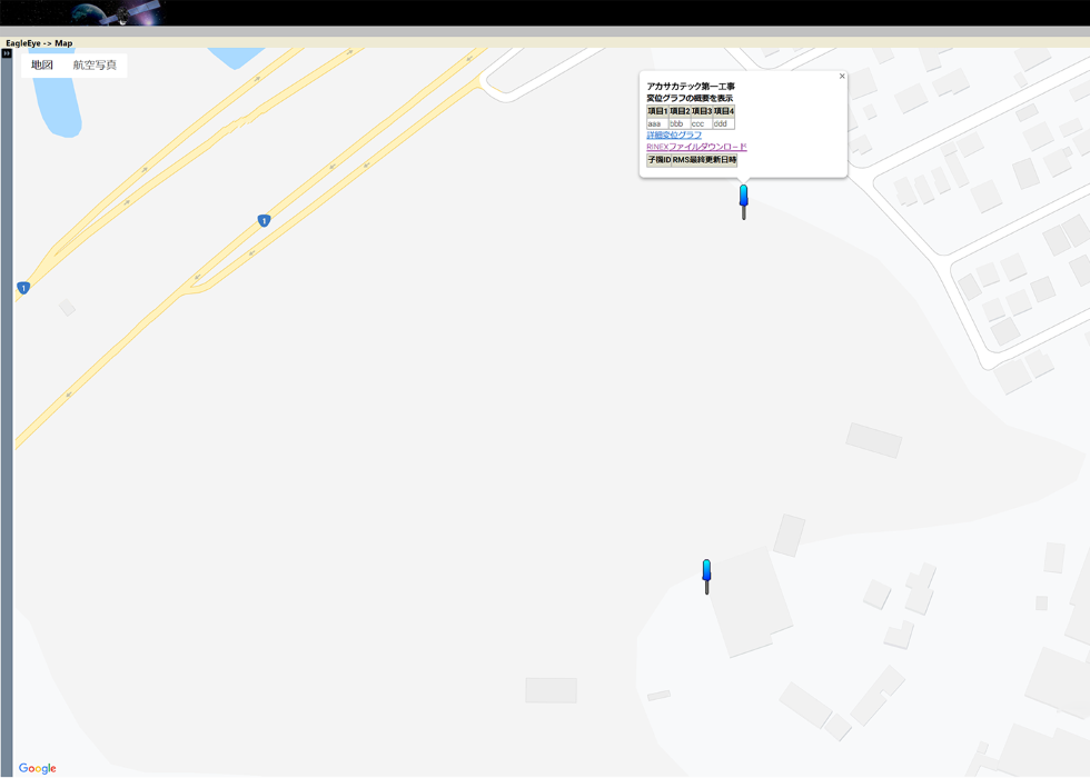 Site information registration screen
As simple as logging in and registering the worksite.
 Reflecting CAD drawings
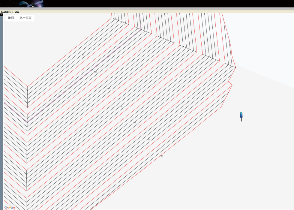 Reflecting CAD drawings
View data as CAD Drawings.
Flexible Use-case
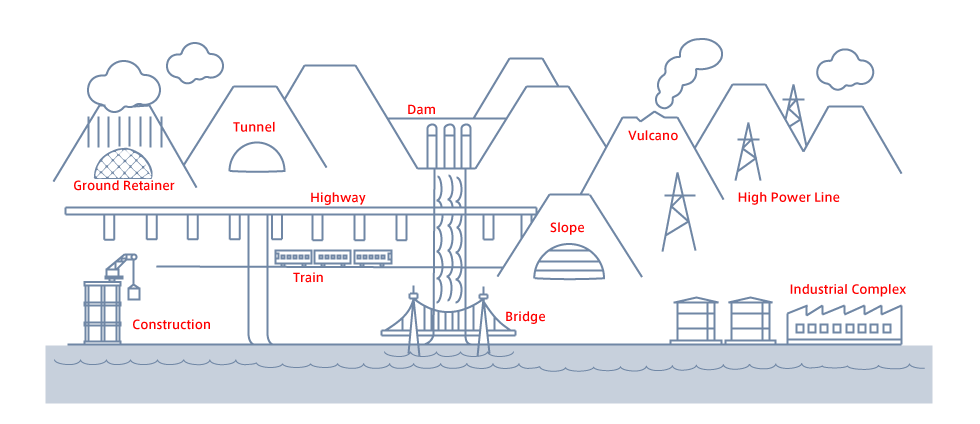
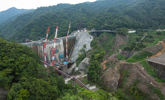
The EagleEye system can be deployed across multiple operations, from bridge building, dam construction, tunnelling, rail laying, volcano monitoring etc.
Specification
Measurement
| Signal | L1 Wave (1575.42 MHz) for Static Positioning |
|---|---|
| Data Epoch Interval | 15 Seconds |
| Analysis Interval | 15 Minutes |
| Analysis Precision | ± 5mm rms (Environment Dependent) |
| Monitoring Setup | Up to 9 Monitoring Station per 1 Base Station |
Monitoring Station
| Dimension | 300 x 300 x 151 mm (Not including antenna) |
|---|---|
| Voltage | AC 100V |
| Operating Temperature | 0℃ ~ 60℃ |
| Operating humidity | 5 to 95% (excluding condensation) |
GNSS
| GNSS | GPS L1 C/A、GLONASS L1、BeiDou B1(GLONASS and BeiDou are used exclusively) |
|---|---|
| Raw Data Output | Proprietary Binary Format |
| Antenna | AR170 |
| Usable Area | Within NTT Docomo Service Coverage Area |