GPGlove Grab Vessel Guidance Management System
Product Summary

- i-Con
- Sea
GPGlove is a positioning guidance system that uses GNSS and/or TS for highly accurate positioning data. Compatible with multiple use cases, such as crane directing for dredging or vessel directing for over water pile driving operations. The data of the specific work areas can be selected, exported or printed out.
Features
GPGlove Main Features
- Display Current Position and Objective Position, Operation Guidance and History Feature
- Visualised Operation History with Colour Coded Objectives
- Real Time Record Keeping
- Compatible with Multiple Coordinate Systems
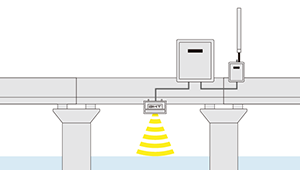
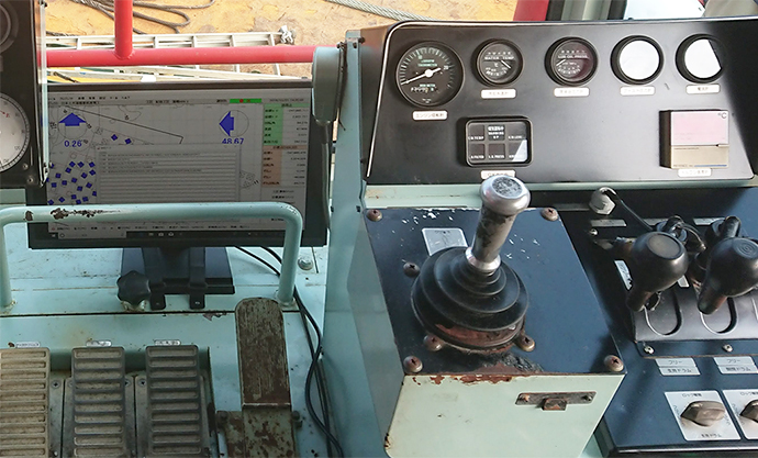
System Overview (Network Based RTK-GNSS)
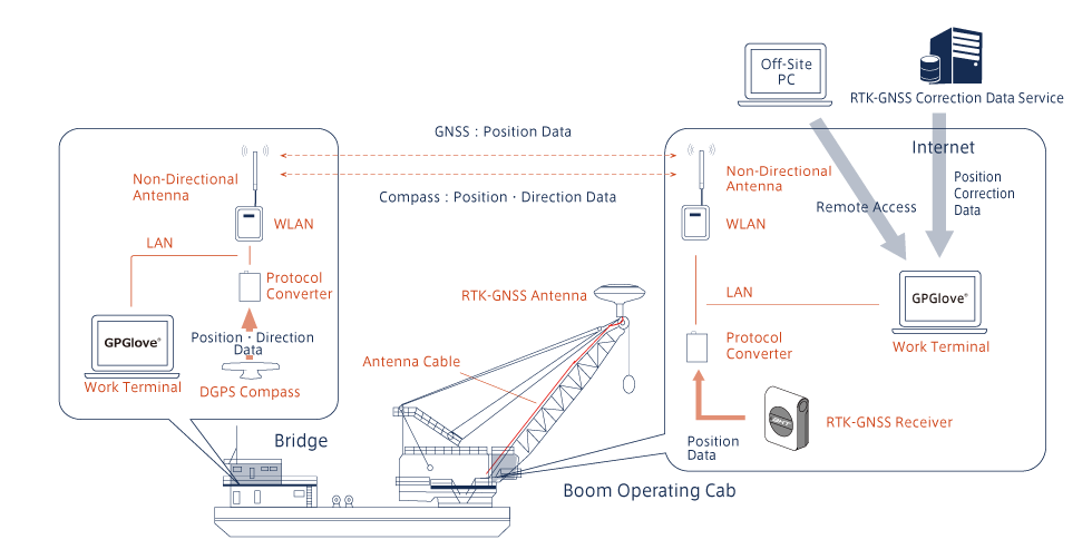
DGPS Compass and RTK-GNSS Receiver Installed on Boom Tip.
System Example
| Work \ Accuracy | Accuracy 1m-Level | Accuracy 1cm-Level |
|---|---|---|
| Vessel Guidance | Only DGPS | DGPS, RTK-GNSS Receiver(2) |
| Boom Guidance | DGPS compass + DGPS receiver on the boom top | DGPS compass + RTK-GNSS receiver on the boom top |
System Makeup and Setup can be tweaked according to each operation needs
Recomended Use-Case: 1m Accuracy for Artificial Reef Placements, cm Accuracy for High-precision Dredging
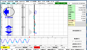
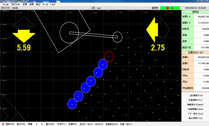
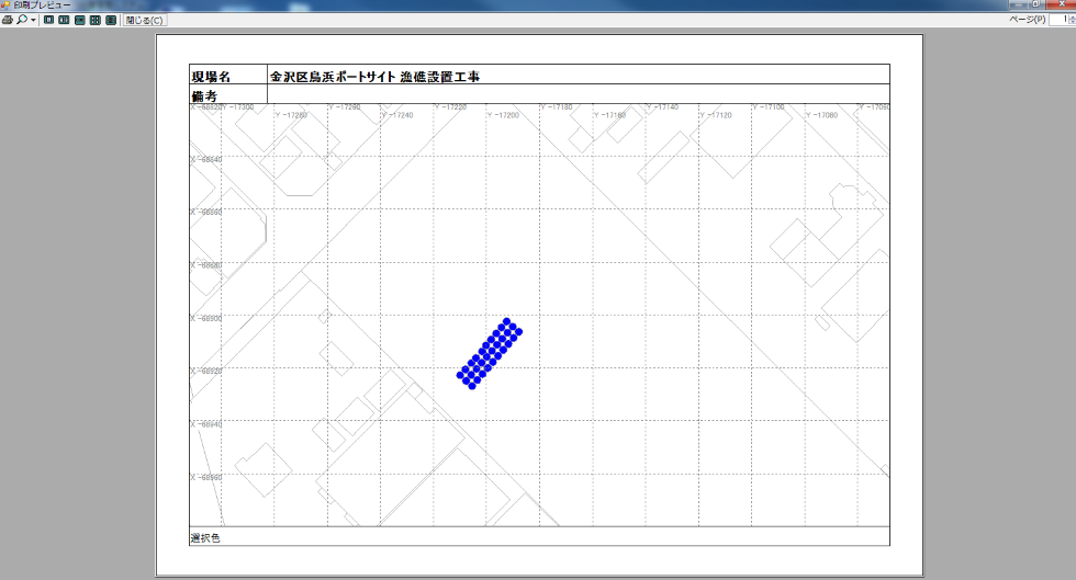
Display Example
Objectives can be specified by using coordinates or work area X, Y position. Guidance for both vessel and Boom are done separately for a complete guidance system. Randomised priority can be used in the event that there is no specific order needed for objective completion.
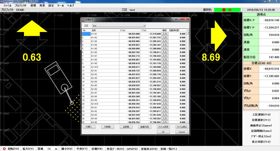
Create Objective Point
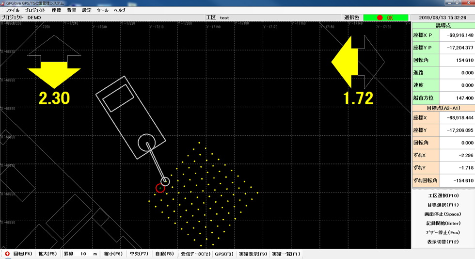
Objective Guidance

Boom Guidance
Export, visualise or print out operation records for all combined operations or only for specific work areas.
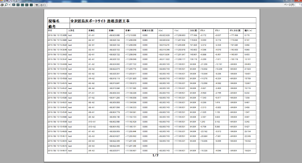
List of achievements
View Achievements
Feature Overview
Operation Guidance and Record Keeping
Guidance and record keeping are done on the computer, avoiding human error and simplifying operation. Automatic progress tracking is also in place by automatic colouration of completed objectives.
Coordinate Settings
Choose from various coordinate types from Old Japan to Internal Standard Coordinates.
Display Type: Geometric
Display the operation guidance as simple geometric shapes to represent surrounding areas and objects. Position can be displayed as raw coordinates.
Display Type: DXF
Display the operation guidance on top of DXF Map Files. Compatible with version R12, R14 and 2000. Compatibility issues may occur regardless of version use. ※It may not be possible to load and display the file.
Work Area Definition
Use X, Y value to a maximum of 100 to define a work area. Raw coordinates can also be used.
Objective Settings
Define objective location via X, Y or raw coordinates. Automatic multi-objective placements (e.g. repeating patterns) can also be done by entering a few parameters such as number and angles.
Display Setting Customisation
Customisable display colours.
Guidance Mode
Objective Guidance
Guidance to selected objectives. Nearest objective method can also be done by left clicking the mouse for additional options.
Coordinate Guidance
Guidance to specified coordinate or point.
Simple Guidance
Create an overlay on top of the current position to indicate the desired position. As an objective is completed, the next objective will be automatically chosen.
Operation Recording Mode
Random Recording (Boom)
Select an area without specifying an objective to start random recording mode.
Random Recording (Vessel)
Select an area without specifying an objective to start random recording mode.
Both objective coordinate and current position coordinate can be recorded simultaneously with colour coding options available. Depth recording can also be done manually.
View Operation Information
View History
Display generalised operation overview data or display only specified generalised work area data. Both methods can be printed out.
View Data
Display a more detailed view of the data in a selected work area. This data can be printed out.
Customisation
Customise the data representations, this can include data specific colouration, range specific colouration or date specific colouration.
Reporting
Display and print the data in report format.
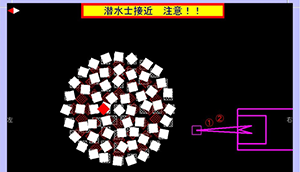
Operation Examples (Picture Example)

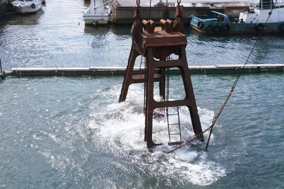
Guidance to wave block location and record wave block placed position. Guidance to dredging location and record worked location. These are just some example use-cases for GPGlove.
Customer Interview
We interviewed Asahimaru Kensetsu, one of our valuable customers to get their insight regarding our product. The following video will go through the unusual circumstances and requirements of the project and how we work together to develop an entirely unique solution using GPGlove.
Youtube Link
https://youtu.be/rzclhwJwjjE