TrackLink Underwater Tracking and Locating System
Product Summary
- Sea
TrackLink is a tracking and locating system for underwater environments utilising underwater soundwave transponders and transmitters to determine and track the object. TrackLink is a must-have system in any underwater operation to get a good grasp of the situation that lays ahead.
Features
TrackLink Main Features
- Functions with Little Trouble in High Noise Area
- Possible Intermediary Data Relay
- Varying Distance and Accuracy Options Available
- Small, Lightweight and Simple
Equipment Overview
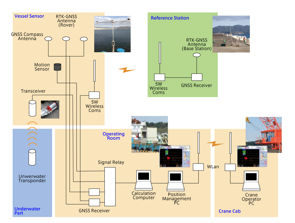
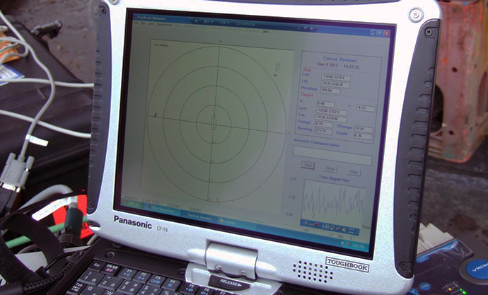
Using both highly accurate GNSS positioning data and transponder data, the exact location of the device can be calculated and visualised on the screen for easy analysis.
TrackLink Main Functions
- Track Locations of ROV/AUV, Objectives and Ship via Coordinates
- Show Ship’s Position and Mooring Relational Data
- Tug Boat (Side Scan Sonar) Coordinate Position Records
These things can be done in real time and underwater positioning data can be serially output.
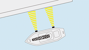
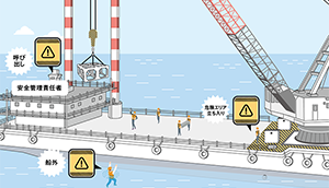
Man Made Coral Reefs Position Management(Use Case)
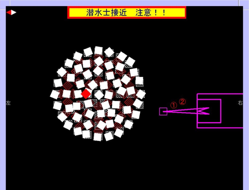
Attaching 2 transponders during submergence will provide both positional and directional record of the dropped structure. The transponder can then be recovered afterwards to be used again.
ROV/AUV Position Management(Use Case)
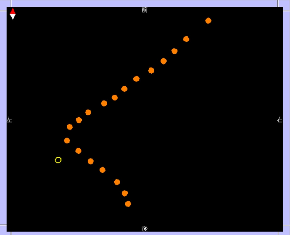
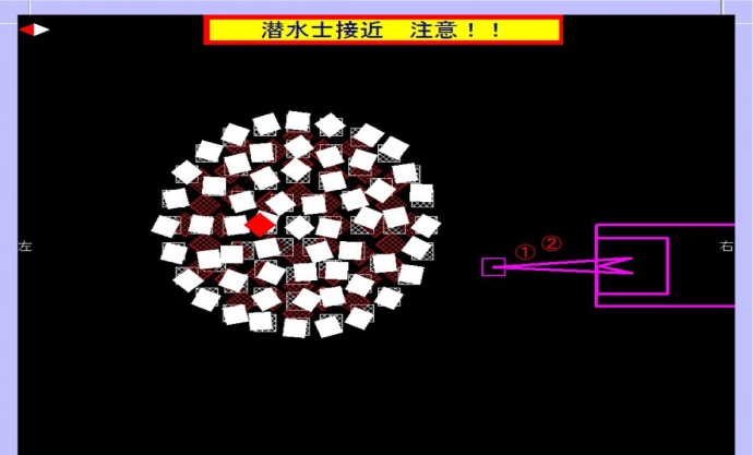
Attaching a transponder to an ROV/AUV will provide patch tracing to keep track of cable location during underwater cable laying operations.
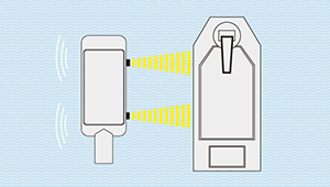
USBL (Ultra Short BaseLine) Tracking and Communication
USBL is a tracking method that utilises BASS (Broadband Acoustic Spread Spectrum) for low false alarm rate, highly accurate positional, directional and depth tracking underwater.
The system basically boils down to communication between the transceiver and the underwater transponder, where all the other calculation and processing is done on the workstation connected to the transceiver. When the transponder receives a signal from the transceiver, it will send back data where the transceiver will send the data via serial connection to a workstation to be processed and log the positional data of the transceiver and transponder. The data is presented in ASCII format where it can then be easily exported.
In the case that GNSS positional data is utilised, the data received from the transponder is then analysed to determine the location of the transponder. With the addition of a GNSS Compass, the direction of both the transponder and transceiver can be determined while also increasing the data accuracy.
Specification
Transceiver
The TrackLink Series is separated into 3 major categories, the LC (Budget), MA (Standard), HA (High Accuracy) model. There can be 8~16 Transponder for every Transceiver.
- Short Range Model: TrackLink 1500 Series
- Medium Range: TrackLink 5000 Series
- Long Range: TrackLink 10000 Series
| Transceiver Type | Max Transponder | Frequency | Frequency (Modem) | Beamwidth | Working Range | Accuracy | Slant Range Accuracy | Dimension | Weight |
|---|---|---|---|---|---|---|---|---|---|
| TrackLink1500 | 16 | 31.0~43.2kHz | 26.0~45.0kHz | 120° | 1000m | 3° (LC), 1° (MA), 0.25° (HA) | 0.2m | 12.6 x 12.6 x 24 cm | 3.5kg (Dry), 1.2kg (Underwater) |
| TrackLink5000 | 8 | 14.2~19.8kHz | 12.75~21.25kHz | 120° | 5000m | 3° (LC), 1° (MA), 0.25° (HA) | 0.3m | 12.6 x 16 x 26 cm | 5.2kg (Dry), 2.3kg (Underwater) |
| TrackLink10000 | 8 | 8.4~11.7kHz | 7.5~12.5kHz | 90° | 11000m | 3° (LC), 1° (MA), 0.25° (HA) | 0.4m | 12.6 x 27 x 25.2 cm (HA)12.6 x 12.6 x 32.2 cm |
3kg (Underwater) (HA) 3.6kg (Underwater) |
Transponder
Each transponder is made specifically for its receiver’s frequency, so it is not possible to mix and match. Depending on use, an external battery may be needed, a remote model (Sound extension) is also possible.
| Type | Compatible transceivers | Beamwidth | Wave Power | Range | Weight in water | Power Usage |
|---|---|---|---|---|---|---|
| TN1505B | TrackLink1500 | 210° (Uncontrolled) | 25W | 500m | 0.86kg | 10W (Transmitting) 1.6W (Receiving) |
| TN1510B | 32W | 1500m | 2.0kg | |||
| TN5015C | TrackLink5000 | 30° | 200W | 5000m | 16.2kg | 500W (Transmitting) 8mW (Passive) |
| TN5010C | 60° | 100W | 4000m | 10.2kg | ||
| TN10015 | TrackLink10000 | 60° | 1200W | 11000m | 1000W (Transmitting) 8mW (Passive) |
|
| TN10010 | 210° (Uncontrolled) | 400W | 7000m |
Output Format
The workstation can output positioning data in four different formats, including a compatible format.
- TP2
- LXT
- LQF
- GLL