GPMate-ECHO GNSS Positioning and Bathymetry System
Product Summary

- i-Con
- Sea
GPMate-ECHO is a bathymetric system that utilises GNSS for positioning data. By simultaneously using GNSS positioning and an echo sounder, the precise depth of the water and the location can be displayed and recorded in real time. Some use cases include bathymetry survey, artificial reef placements, buoy tracking in the coastline, canals, rivers and even dams.
Features
GPMate-ECHO Main Features
- Over 20 Years of Experience, an Industry Leading Product
- Display Current Position Real-time Depth Data
- Automatic Cut-Lines
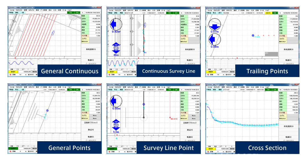
- Compatible with Multiple Measurement Modes
Latest Version Added Features
- Windows 10, 64 bit Compatibility
- GNSS Compass Compatibility
- Jenoba VRS Ntrip Compatibility
- Wave Speed and Position Correction
- Multi-Pass Comparison
- Optional Additional Distance Auto-Cut
- Optional CSV Data Export
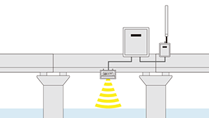
System Overview (With Network Based RTK-GNSS)
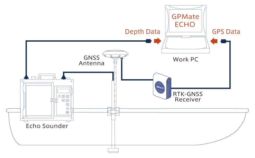
GNSS Receiver Automatic Setup
Whether using RTK-GNSS, Network Based RTK-GNSS or DGNSS, GPMate-ECHO is compatible with receivers that utilise NMEA (GGA) Data Format. GPMate-ECHO is able to automatically set up the GNSS receiver and any settings wished to be changed can be done so easily via software.
※Compatible receivers are specified.
Compatible with Jenoba VRS Ntrip
Using only a network communication dongle or cell capable computer, GPMate-ECHO can utilise Jenoba VRS Ntrip without the need for specialised equipment. The setup process can be automated via software.
※Specific TOPCON GNSS Receivers are compatible
※Contract with Jenoba must be made before utilising Jenoba VRS Ntrip
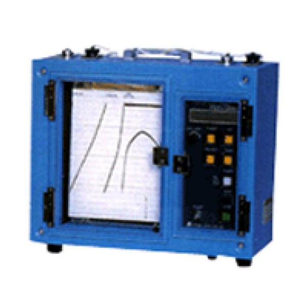
Echo Sounder
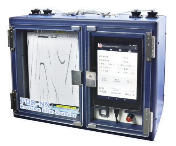
Compatible with multiple Digital Echo Sounder.
Senbon Denki: PDR-NX1130, PDR-NX1250, PDR-1200(W), PDR-1300(W), PDR-2200(W), PDR-8000s, PDR-601
Tamaya: TDM-9000, TDM-9000A, TDM-9000B, TDM-B II, TDM-B III
Compatible with Cut Commands with optional pitch and added distance for automatic cutline printing.
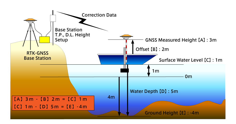
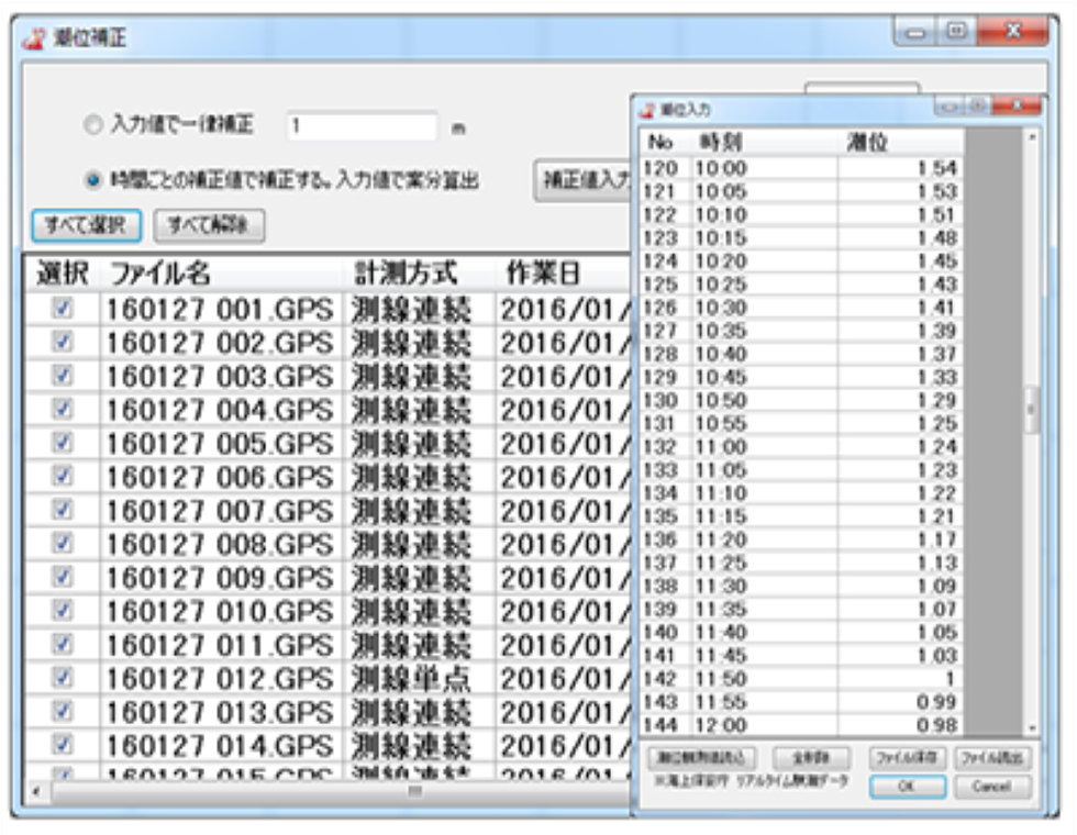
Automatic Wave Correction
Using vertical positioning gathered from RTK-GNSS to determine current wave height and perform corrections using the data gathered. With the option of exporting raw, unaltered data.
Automatic Cut, Naming and Marking
Automatic Cut
Using GPMate-ECHO, once a certain previously set distance is reached, an automatic cutline will be drawn on the record paper during operation, eliminating the need for manual cuts.
※Depends on manufacturer and model
Line Naming and Marking Number
Just like the automatic cut feature, the measurement lines can be automatically annotated and named along with automatic cutline numbering.
※Depends on manufacturer and model
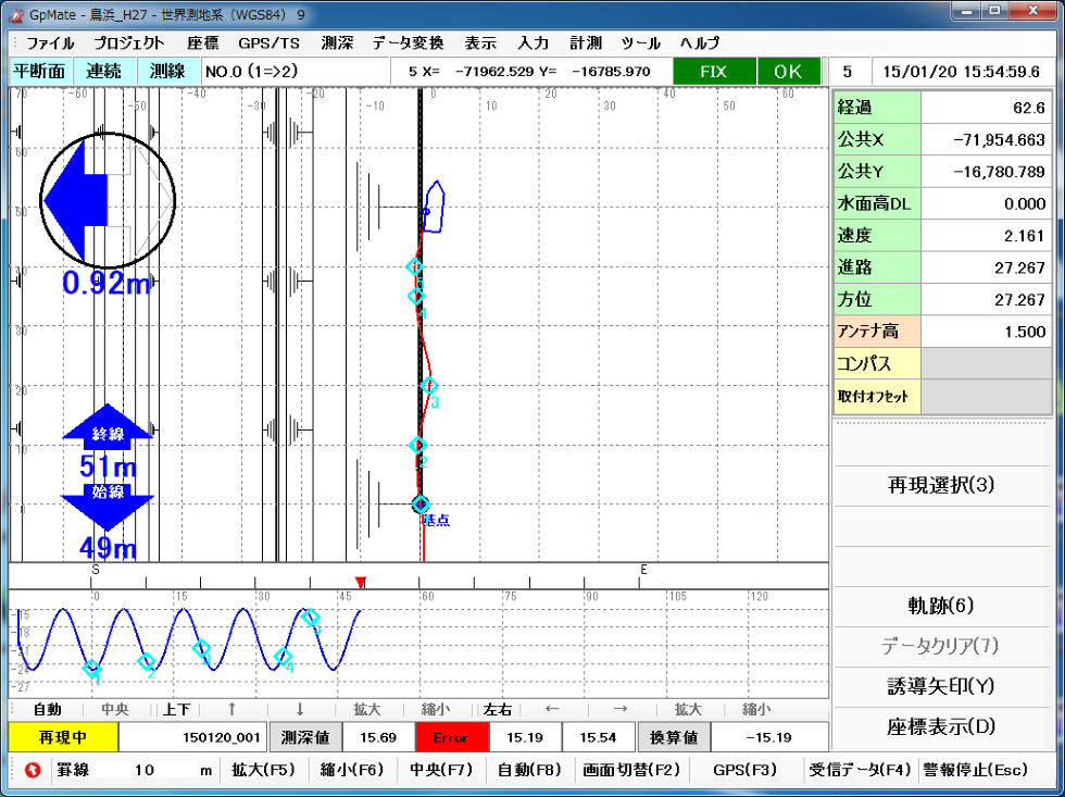
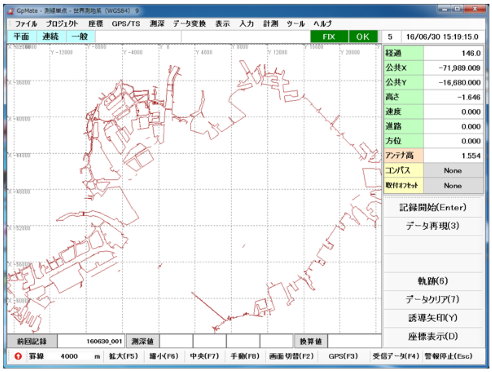
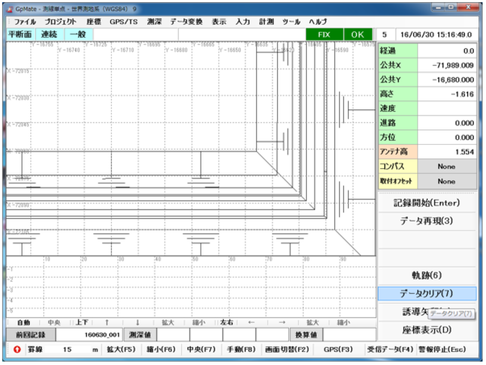
Multiple Measurement Modes (Picture Examples)
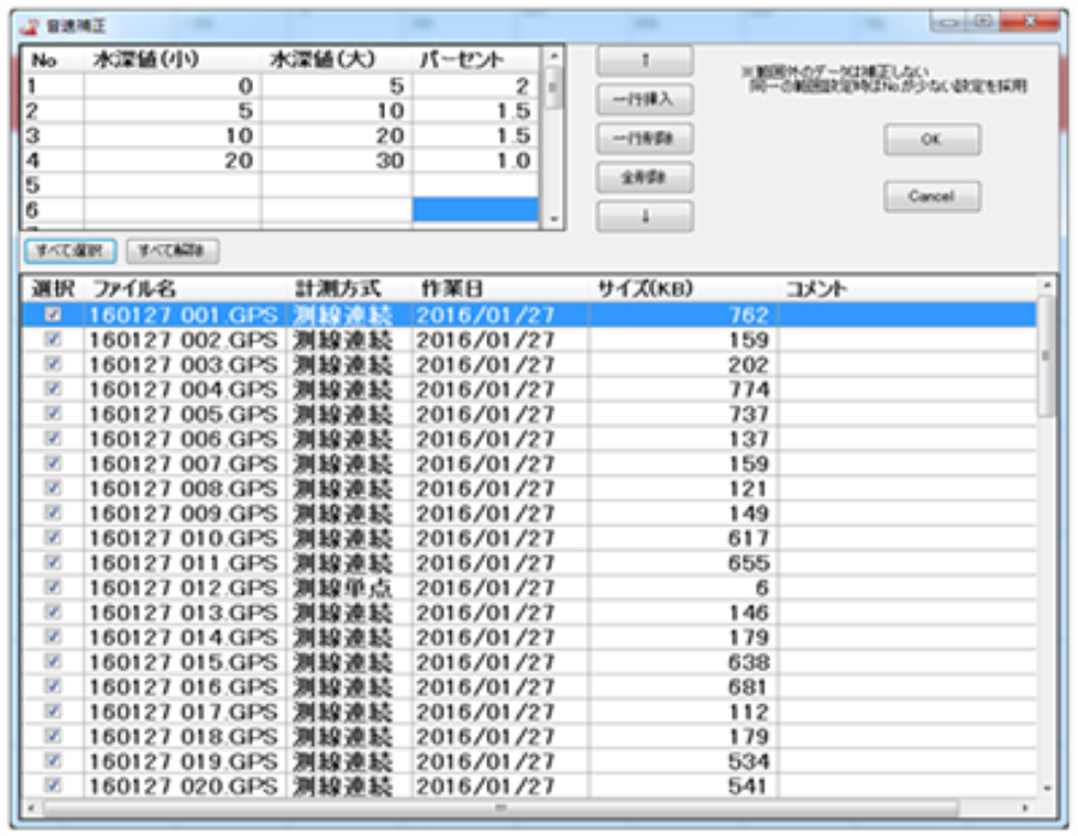
Sound speed correction and tide level correction
It is possible to perform alterations to the data by specifying sound speed changes at a certain depth point. It is possible to perform alterations to the data by specifying wave height at a certain timestamp.
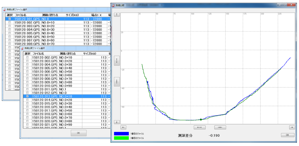
Multi-Pass Data Comparison
Compare depth data side by side during Multi-Pass operations immediately after recording.
DXF・SFC File Read and Display (Picture Examples)
DXF files and SFC files can be read and displayed on the screen.
※DXF(R12・2000)/ SFC(Ver.3.1)
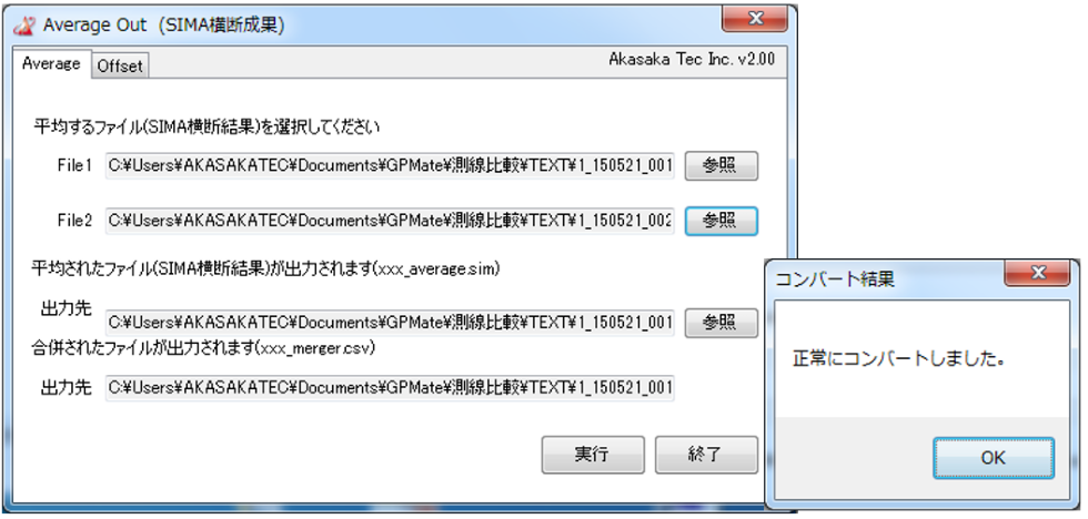
SIMA Data Averaging Software
GPMate-ECHO comes equipped with a SIMA File Averaging Software which combines 2 SIMA Files, takes their heights and outputs them into a single SIMA File.