SmartPile Ground Improvement Management System
Product Summary
- i-Con
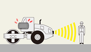
SmartPile is a piling guidance and management system that utilises GNSS positioning. SmartPile solves the problem of traditional less efficient methods that require more crew, working dangerously close to the pile and no record keeping. By utilising IoT and RTK-GNSS Technology, SmartPile brings highly accurate visual guidance along with record keeping function for a safer, easier and more efficient system.
Features
SmartPile Main Features
- Utilising RTK-GNSS to accurately track and guide Pile Driving Operations
- Reduce risks and labour during guiding operation
- Automatically tracks operation progress
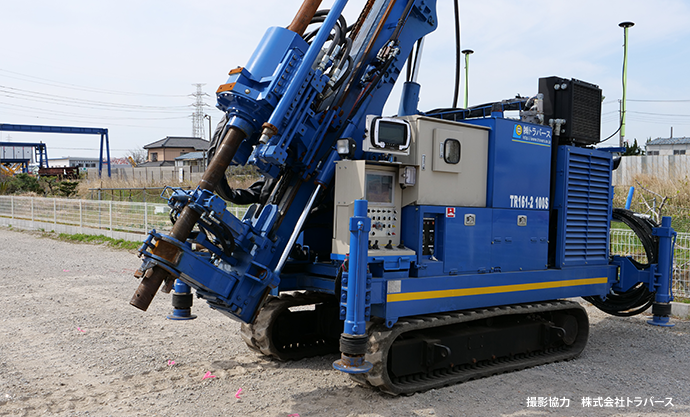
- Utilising the Rugged Multi-Purpose HDT320
System Overview
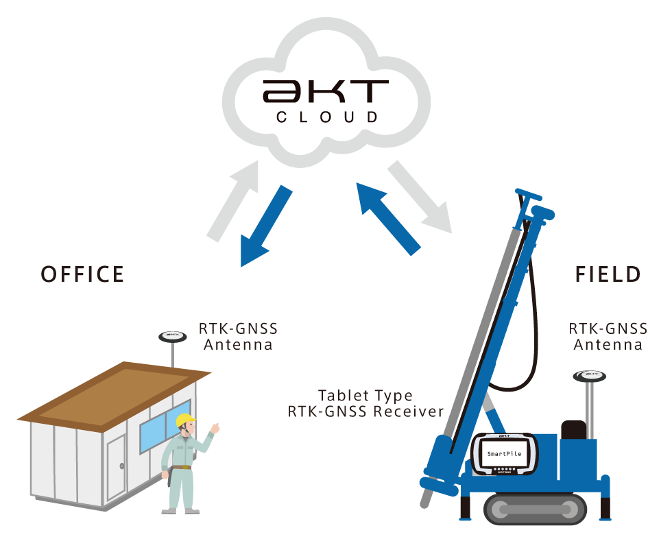
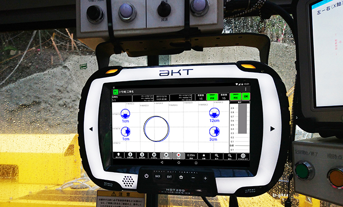
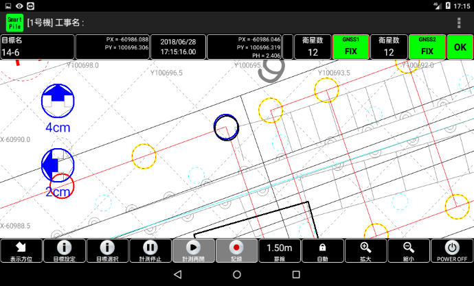
SmartPile utilises the HDT320 to direct the operator to the target that is used in pile driving operation guidance and management. Once the task is completed, the marker will automatically change colour for easy identification. The operation data will be sent to the cloud server for remote analysis.
Efficient and Safer Operation
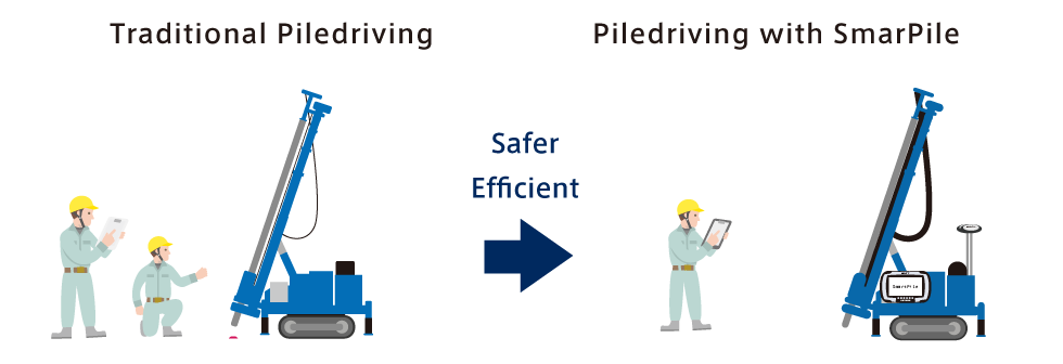
Utilising highly accurate RTK-GNSS positioning and remote guidance to drastically improve operational efficiency, quality and safety. Eliminate the need for manual upclose guidance increasing workplace safety while also reducing labour needs.
Pin-point Accurate Guidance and Tracking
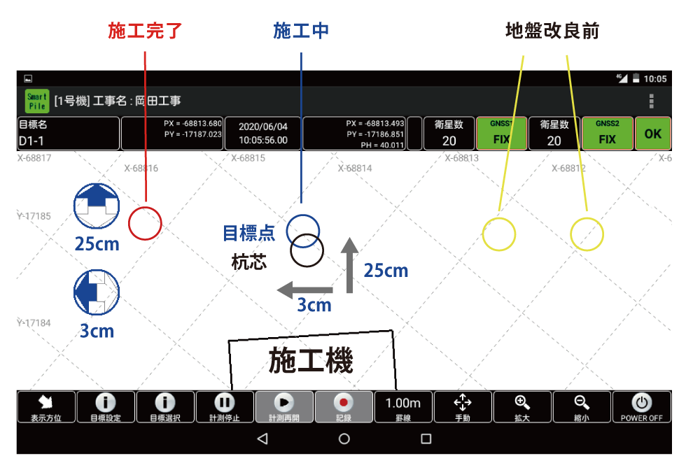
SmartPile keeps track of completed, in-progress and planned tasks automatically for ease of operation progress tracking. Reduce the risks of human errors, work risk and complexity by eliminating the need for manual tracking.
Quick and Easy Remote Operation Management
Pre-Operation: Planning, Setting and Uploading of Operation Data
Mid-Operation: Real Time Analysis of Operation Progress and Remote Support
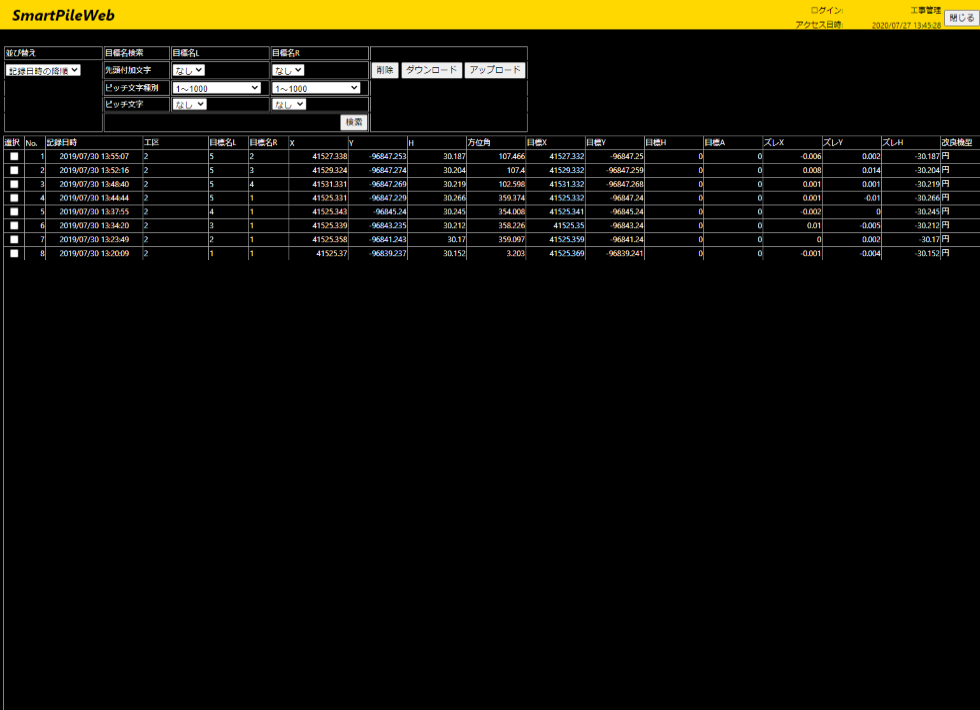
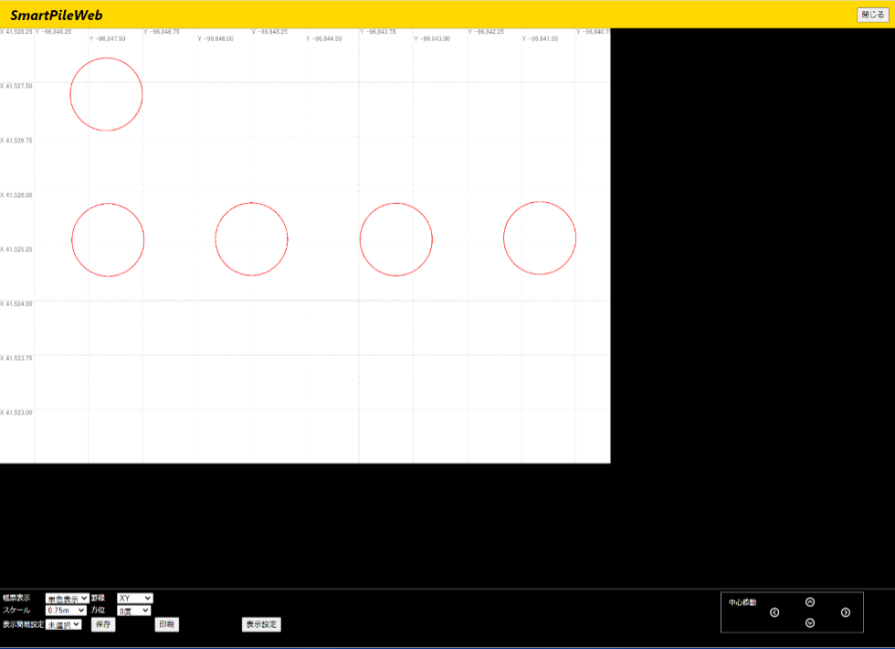
Post-Operation: Access Operation CSV Data for Analysis, Exporting and Reporting
Ease of Objective Setting and Exporting
- Set objectives by using the objective coordinate or by using relative position shifting by using the distance of 2 pre-piled piles.
- The operation results can then be accessed remotely for direct print-out or download the data in CSV file format.
Rugged Multi-Purpose HDT320
Designed for the rugged, unforgiving environment of the worksite, the HDT320 is a tablet designed with the user and the workplace in mind. Equipped with 2 dual-frequency GNSS modules, tough IP67 rated casing, vibration and impact resistant body, the HDT320 will be an indispensable workhorse equipment for multitudes of different operations.
Dual-Frequency RTK-GNSS Receiver Terminal HDT320 [Page Link]