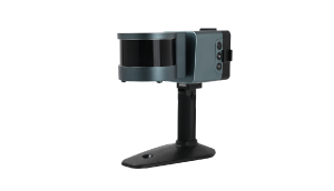
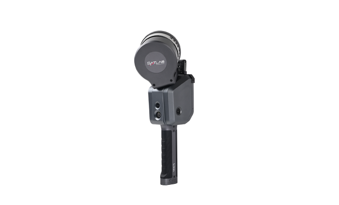
SATLAB Lixel X1 LiDAR SLAM Handy Scanner
Product Summary
- NEW
- i-Con
SATLAB Lixel X1 is a 3D LiDAR Handheld that utilises Simultaneous Localisation and Mapping functionality that when combined with an innovative algorithm, for improved 3D point group data.
※This product is part of 『LiS㎥ (Cubism)』 Set
※Not sold separately, no inhouse hardware support service
Features
SATLAB Lixel X1 Main Features
- Compact
- Real Time Decode
- Long Continuous Operation
- Real Time Colour Rendering
- Highly Accurate 3D Data Points
United Design and Minimal Operation
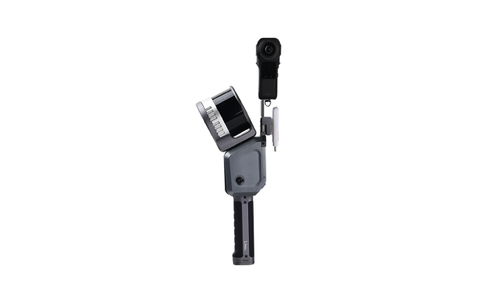
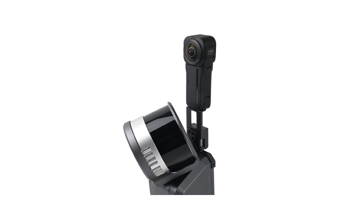
Lixel X1 integrated design of LiDAR, Visible-light camera, motion camera, high-precision inertial navigation technology and high performance computing eliminates the tedious operation steps and makes your scan easier and simpler. And the complex structure is of excellent heat-sinking capability.
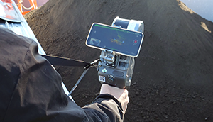
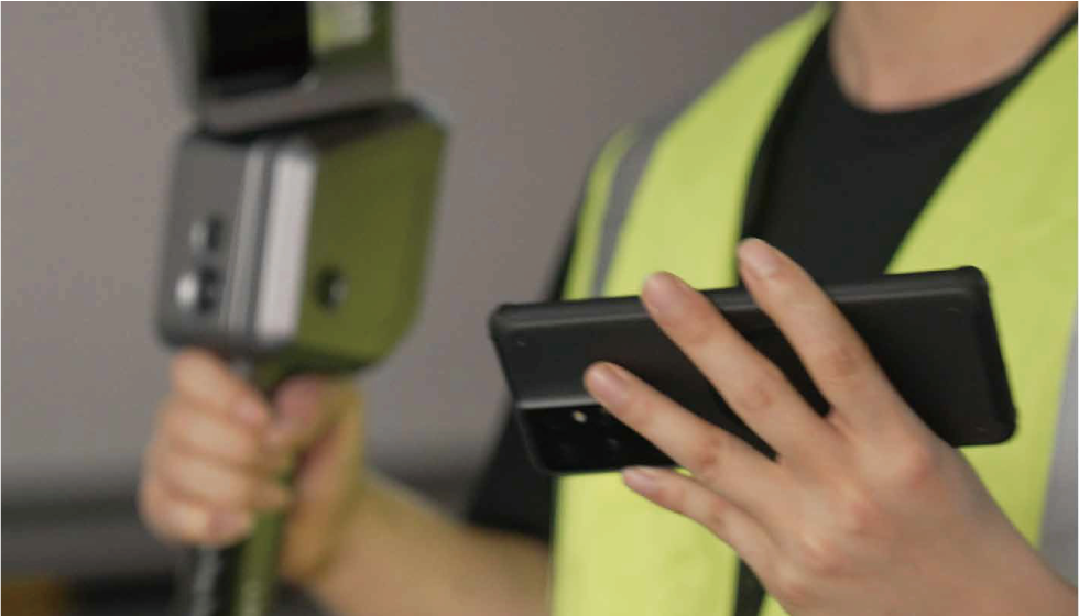
Fast Capturing and Real Time Modelling
Utilising real-time data decoding and modelling technology, point cloud data is immediately generated within a mere 5 seconds inside the scanner right after scanning. This allows for the immediate monitoring of reconstruction effects in the LixelGo software, ensuring high-quality data.
Long-term Continuous Operation Breakpoint Scanning
60 minutes of ultra-long continuous operation time and high capability in resuming the scanning from the break-point.
No need for segmented scanning in large scenes and greatly improves the efficiency of measurement and data analysis.
Real-time Colour Rendering
High-precision vision and laser fusion technology generate true colour point clouds in real-time to twin the real world.
Robust and Reliable
With the industry-level SLAM algorithm, the Lixel X1 is used to generate high-precision point clouds for complicated areas like long corridors, tunnels, etc, and largely improves the stability of mapping for weak texture scenes.
Moreover, the cumulative error of multi-source data can be reduced significantly by combining the software solution.
Application
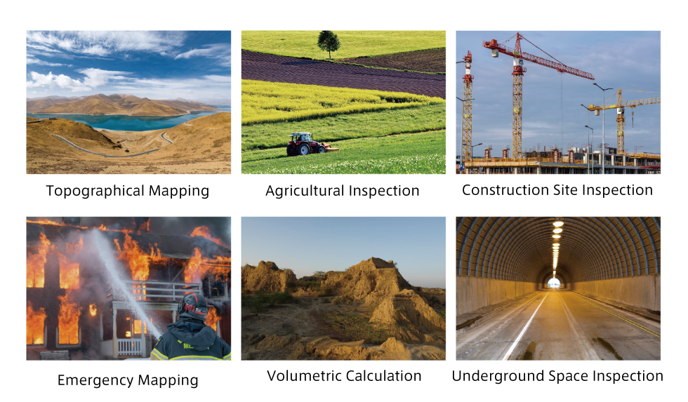
Lixel X1 Handheld SLAM Scanner can be used in many applications, such as Topographic Mapping, Agriculture & Forestry survey, Engineering Survey, Emergency Mapping, Volume Calculation, Underground Space Mapping and more.
Specification
| Operation Range | 0.05~120m |
|---|---|
| Laser | Class 1 (905 nm) |
| Channels of Resolution | 16 |
| Accuracy | <2cm |
| FOV | 360×270° |
| Points/s | 320,000 |
| Processing | Real-time processing |
| Display | Live streaming point cloud |
| Carrier | Handheld / Backpack / UAV |
| Scanner Weight and Dimensions | 1.9kg(with battery), 138 x 90 x 381 mm |
| Camera | Wide field x1, positioning x3 |
| Operation Temperature | -20℃~50℃ |
| Battery Life | 1.5h |
| Single Scanning Time | 60 min |
| IP Rating | IP54 |
| Storage Capacity | 1T SSD |
| Point Cloud Format | .las,.laz |
| Power Supply | V-mount 46.8 Wh, 14.4V Battery |
| Wattage | <30w |
※This is a product from SATLAB
Specifications can change without notice
For the latest specification, please see SATLAB website
SATLAB:Lixel X1 Handheld SLAM Scanner [External link]
Other products information
LiS㎥ Ship Cargo Volumetric Measuring System
LiSm³ (Cubism) is a cargo volumetric measuring system for vessels such as the hopper barge, that utilises LiDAR-SLAM to take point cloud data to calculate the volume of the cargo.
LiS㎥ Ship Cargo Volumetric Measuring System[Page Link]